We cruised down 89 South cresting the big rise and dropped two thousand feet into Bittersweet. Then we ran south along the massive cliffs that marched on like sentinels preening in their bright colors. Then they dipped down and turned east while we continued south into a land of hills that looked like a giant child had dumped their dump truck loads haphazardly on the plains.
In Cameron we hooked a right onto AZ 64 and the land rose higher and was soon covered in juniper and scrub pine and many other plants. As we motored closer to the park we could see Humphrey's Peak capped in snow down by Flagstaff. Arizona is a land of contrasts.
Soon we came to this. We had to wait in line as the Pink Jeep tours took their turns.
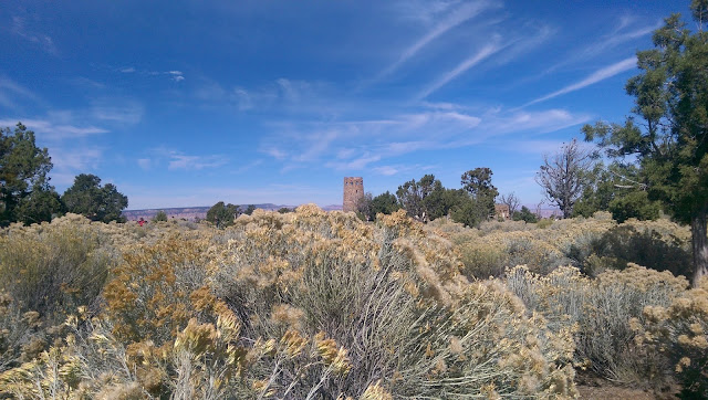
The first stop on the route is the Desert View visitors center with the Desert View Watchtower hovering over the view. It is one of the iconic landmarks on the tour built in 1932 by architect Mary Colter. Unfortunately for us, the tower was closed for renovations. There was a park ranger standing on the outside stairs to keep people from going up. The sidewalk takes you right past these stairs. As I approached, the ranger jumped off the steps, spread her arms out and began sidestepping between me and the stairs. I guess she was afraid I might run up them.
The obligatory Grand Canyon selfie. It was amazing all the people with selfie sticks for their cameras and the GoPros mounted on sticks and controlled by cell phones. Becky wondered what kind of culture we have become that everyone has to take selfies in front everything. An absolutely cool one!
Next was Navajo Point and Lipan Point.
Here you can see the river running through the Unkar Delta where the Indians used to live. We could see this Delta from the North Rim.
This sign is at Moran Point(?).
 |
| Duck on a Rock |
From the VC we walked the paved trail down to Yavapai Point and Geology Museum. We took the bus back to the parking lot to pick up the Tahoe. The road to Hermit's Rest is gated and only accessible to the buses but I was able to get a permit from the rangers and the code for the gate so that we could drive out by ourselves. The bus ride took seventy minutes to get to Hermit's Rest I think we did the whole round trip in less than 70 minutes.
 |
| Lots of these elk traipsing around. |
From Maricopa Point we could see the bridge for hikers going rim to rim and for the mule rides.
 |
| The bridge. Someone take me!! |
The clearing at the top of this photo is where the old mining equipment was at for hoisting out the uranium. The owner of the mine wanted to build a hotel that curved with the crater and ran from the top of the rim to the bottom.
This building was built in 1914 as guest house and jumping off point for mule rides and hiking into the canyon. It was also built by Mary Colter designed to blend into the landscape and look old.
More of these big boys. Only saw several with antlers.
On the way out of the park the sun was setting and we stopped back at Navajo point and Becky got out to snap some photos of the sunset.
We trucked back to Cameron and ate some supper at Cameron Trading Post. The food was plentiful and good. We spent some money on trinkets and then drove back to Page in the dark. On the road above Bittersweet we stopped and stared at the brilliant stars. In the almost complete blackness the Milky way was absolutely brilliant. Then it was on home to release the hound from her cage and rest for the fun of a new day.


No comments:
Post a Comment