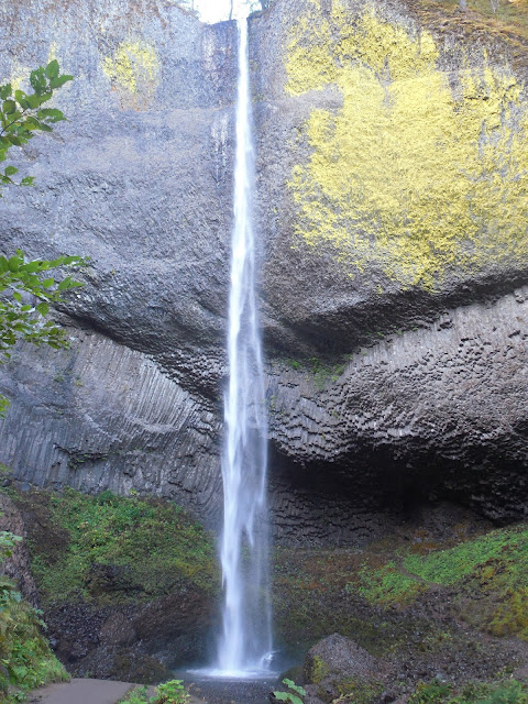
Sept 8 We set off to see the above mentioned because it is listed as an All American Road and because I had heard from several people that the drive was a beautiful one and we were not disappointed. If you are in the area and have a day to spare, I highly recommend driving this historic road.All the waterfalls can be seen from the road. Most of the activities are accessible and the scenery is top notch. This road made the top 5 and I'll post on that another day. Right now I'm really far behind and trying to get caught up!
 |
| The Vista House |
Vista House sets on a high bluff along the river and the road wraps around it. From the second floor balcony, the views were stunning both east and west. I have a hard time imagining the pioneers trudging along this route in their wagon trains or floating down the river. They were determined people and often reaching Oregon and the Columbia was the hardest part of the trip for them because of how rugged the country is.
 |
| East |
 |
| West |
After vista house we dropped down to river level to run through the heavy woods and see the waterfalls.
 |
| Just a shot of the road and the old guard rails covered in moss. |
The Columbia River Gorge National Scenic Area is administered from here at Multnomah Falls. There is a visitors center to get the National Historical Site stamp, a gift shop, hotel and restaurant. People came from all over to see these falls and stay here. Franklin Roosevelt loved this area.
After Horsetail Falls, the old road joins I-84 and the next exit is for Bonneville Dam also a National Historic Site and who can't pass up taking a dam tour or some dam pictures. This place turned out to be pretty cool.
 |
| This is the power generation dam |
 |
| The diverter dam. |
 |
| The backside of the power generation dam from the visitor center parking lot. |
 |
| One of the original turbines from the power generation unit. They estimated that the outer edge of the blade traveled 65000 feet per day. |
 |
| Didn't think they were that big did you? |
The engineers who built the dam knew that salmon and other migratory fish needed a way around the dam to get to their spawning grounds in Idaho where they are a key stone species, meaning that life revolves around the fish making it to the area so that everything else survives. So the engineers built fish ladders so that the fish could leap over or swim through to get past the dam.
The visitor's center had viewing widows to see the fish swim past. On the other side of the ladder was a small office where they counter the species of fish as they went by.
The island between the dam and power plant is called Bradford Island. On the western tip of this island is where Lewis and Clark set up camp and explored the region. They named the below rock, Beacon Rock and noted that on the rock are levels marking the high tides of the Pacific Ocean which is 146 miles away. From the dam, the Columbia drops only 14 to the Pacific, a rather shallow run for a river.
Next we stopped at the Bridge of the Gods.
Then it was on down the road.
 |
| What Mitchell had to work with. The tunnel is no longer there sadly but below I-84 stands as a testament to new construction techniques and machinery that Mitchell didn't have and may have never dream about. |
Off I-84 once again on 30 we wound up into the hills and into sage brush once again. This was one of my favorite parts of the journey.
 |
| Looking east from Rowena Crest |
 |
| Looking back at the road as it curls around from the Crest. |
We ended our trip in The Dalles after looking through
The Columbia River Museum and Discovery Center. It was worth the admission price to look around. It had a lot about Lewis and Clark, the local Indians and local history.
We stopped a grocery store, picked up a few supplies and rolled back to the trailer in I-84. There are a lot of little places to hop off and look at the river. Becky went into Portland to meet some friends from the Ravelry.com (a knitting site) and I did some laundry and read a book. P worked on school.


No comments:
Post a Comment